

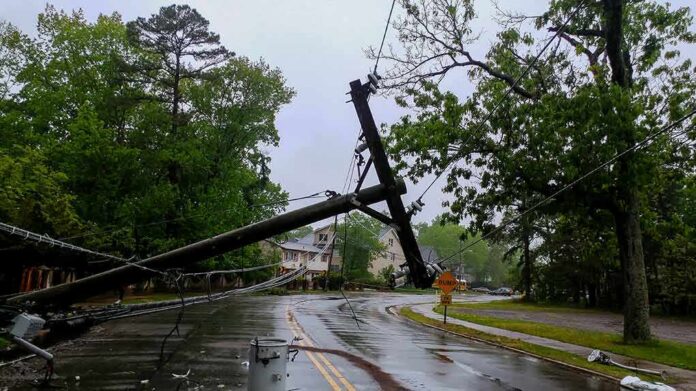
New York’s governor declared a State of Emergency for eight counties as a powerful coastal storm threatens flooding, strong winds, and power outages through the weekend.
Story Highlights
- Governor Hochul declared a State of Emergency for New York City, Long Island, and parts of the lower Hudson Valley.
- Officials warned of coastal flooding, damaging winds, heavy rain, and risky surf through Sunday.
- The storm’s exact track could still shift, but hazards near the coast remain the top concern.
- Residents were urged to avoid unnecessary travel and prepare for possible outages.
Emergency Declaration Targets Highest-Risk Areas
Governor Kathy Hochul said New York City, Long Island, and parts of the lower Hudson Valley face the greatest risk from this coastal storm. She declared a State of Emergency for Bronx, Kings, Nassau, New York, Queens, Richmond, Suffolk, and Westchester Counties. The order aims to speed help, move crews, and protect people in flood-prone zones. Hochul asked residents to take the storm seriously and limit travel where possible to keep roads clear for first responders.
State officials said the most likely threats include coastal flooding, strong winds, heavy rain, and dangerous ocean conditions, especially during high tides. The Governor’s office said crews and equipment are on standby, and emergency operations are active to monitor changing conditions. Low-lying neighborhoods and barrier beaches were told to prepare for water on roads and possible evacuations if tides or surge rise faster than forecast. Beach erosion and wave damage also remain concerns.
What Forecasters Expect and What Could Change
National and local forecasts agree the storm will linger into Sunday, pushing onshore winds and long-duration surf. The main uncertainty is the exact track and how close the low-pressure center comes to shore. A small shift could change rainfall totals and wind speeds inland. Forecasters continue to stress that coastal flooding and erosion risks are the most reliable hazards, while rain bands and gusts away from the water may vary as the system evolves.
Forecast discussions point to better model agreement than a day ago, but they still include confidence bands. That means plans should account for a range of outcomes, especially for neighborhoods known to flood. Residents should check local updates, charge devices, and secure outdoor items that can blow away. Drivers should avoid flooded roads. Utility customers should be ready for scattered power outages if trees or limbs fall on lines during stronger gusts along the shore.
Why Strong Warnings Come Early
State leaders issue early warnings so city and county teams can move pumps, set up shelters, and stage road crews before the first high tide cycle hits. Emergency declarations clear red tape and help deploy help faster when minutes matter. This approach reflects a common pattern with nor’easters: officials flag high-impact risks while track confidence is still improving. The goal is simple—reduce surprise and give families time to prepare without panic or delay.
9 AM Top-of-the-Hour News
Millions are bracing for impact from a powerful Nor-Easter across several states.: “Sandbags and uh just to make sure the water once it does come up this high it doesn't go into the more into the crawl space. ”
These guys are on New York's Long Island… pic.twitter.com/DJ41LMD3pp— Worldwide News Network (@WorldwideNNX) September 26, 2026
For many New Yorkers, the message is familiar but urgent: a long-duration coastal storm can wear down defenses even without record wind or rain. Back-to-back high tides, relentless waves, and steady onshore flow raise flood odds block by block. That is why the state’s guidance stresses simple steps that save lives—stay off flooded roads, keep generators outside, check on seniors, and follow local alerts. If you live near the water, move cars to higher ground now.
Sources:
© theredwire.com 2026. All rights reserved.